

Picture on canvas, author Peter Hermes Furian
FILTER RESULTS
Image orientation: all
horizontal
vertical
square
Filetype: all
photo
illustration
vector
Apply
#782995277
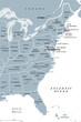 East Coast of the United States, gray political map. Also Eastern Seaboard, Atlantic Coast, and...
#756667558
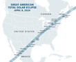 Great American Total Solar Eclipse, on April 8, 2024, political map. Major cities in the path of...
#518149139
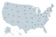 United States of America, gray political map. Fifty single states with their own geographic...
#792777332
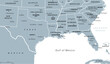 Gulf States of the United States, also called Gulf South or South Coast, political map. Coastline...
#514824675
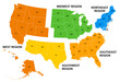 United States, geographic regions, colored political map. Five regions, according to their...
#755106886
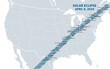 Great American Total Solar Eclipse of April 8, 2024. Political map containing names of cities inside...
#114089218
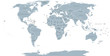 World political map. Detailed map of the world with shorelines, national borders and country names....
#704863201
 Two bold wavy lines forming a rectangle frame. Decorative and snake-like rectangular border, made by...
#514824685
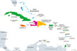 The Caribbean, colored political map. Subregion of the Americas in the Caribbean Sea with its...
#490918514
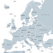 Europe, gray political map. Continent and part of Eurasia, located in the Northern Hemisphere, with...
#567019528
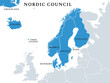 Nordic Council members, political map. Cooperation among the Nordic states Denmark, Finland,...
#631568539
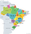 States of Brazil, political map. Differently colored federative units, with their borders and...
#781351286
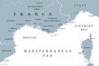 Southern France coastline, gray political map. Southernmost part of France, bordering the...
#566675851
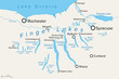
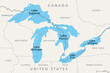 Great Lakes of North America, political map. Lake Superior, Michigan, Huron, Erie and Lake Ontario....
#514824649
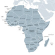 Africa, single countries, gray political map. Largest continent, including Madagascar. With English...
#709943534
 Growth rings of a spruce tree, horizontal cross section, cut through the dried trunk of an European...
#335313989
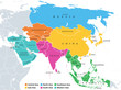 Main regions of Asia. Political map with single countries. Colored subregions of the Asian...
#517123459
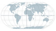 The world with most important circles of latitudes and longitudes, gray political map. Equator,...
#512688858
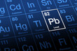 Lead on periodic table. Chemical element with symbol Pb for Latin plumbum, and with atomic number...
#636056856
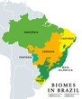 Biomes in Brazil, map of 6 ecosystems with natural vegetation. Amazonia (rainforest), Caatinga...
#757493930
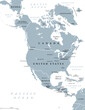 North America, gray political map. Continent bordered by South America, Caribbean Sea, and by the...
#514044463
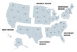
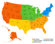 Geographic regions of the United States, political map. Five regions, according to their geographic...
#505701941
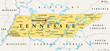 Tennessee, TN, political map, with capital Nashville, largest cities, lakes and rivers. State of...
#585380177
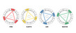 Triangles of the four elements in astrology. The twelve signs of the zodiac are divided into fire,...
#676073599
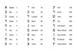 Numeric values of Hebrew letters. Glyphs of the Hebrew alphabet with names and numeration....
#552692464
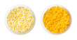 Shredded mozzarella and cheddar cheese, in white bowls. Grated low-moisture mozzarella, and piquant,...
#559119949
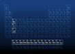 Rare-earth elements, also known as rare-earth metals, on the periodic table, with atomic numbers and...
#750348010
 Finger Lakes region in New York State, in the United States, political map, with most important...
#729986558
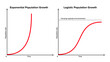 Exponential versus logistic population growth. In reality, initial exponential growth is often not...
#747169654
 United States, geographic regions, gray political map. Five regions, according to their geographic...
#579112518
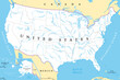 United States, rivers and lakes, political map. The main stems of the longest rivers, and the...
#118274355
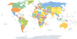 World single states political map with national borders. Each country area with its own color....
add to favorites